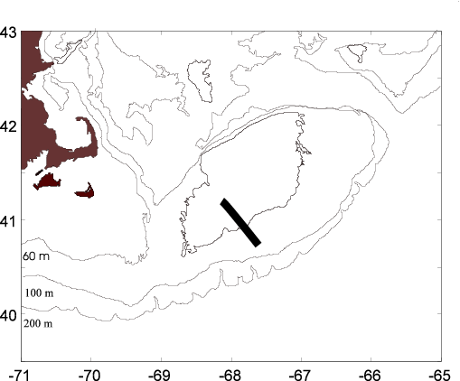
Transects of the tidal mixing front on the southern flank of Georges Bank
July 2001
Biological and physical significance of the tidal-mixing front on Georges Bank
The pilot phase of the U.S.GLOBEC Georges Bank Study examined the tidal-mixing front on the southern flank of Georges Bank in 1995 (see, e.g., Mountain and Taylor, 1996). This persistent and predictable feature is typically located at about the 60 m isobath on Georges Bank (Garrett et al., 1978). The tidal-mixing region defines a boundary between physical (the shallow, well-mixed waters of the Bank crest vs. the deeper seasonally-stratified waters of the flank; Garrett et al., 1978) and biological regimes (Fig. 1). Within the well mixed area, chlorophyll levels and rates of primary production are higher than in surrounding stratified waters (O'Reilly et al., 1987); the phytoplankton assemblage is dominated by diatoms in well-mixed regions vs. dinoflagellates in stratified waters (Cura, 1987). There are characteristic differences in the species composition of the zooplankton assemblage: Centropages hamatus and Pseudocalanus moultoni frequently dominate the Bank-crest, while Calanus finmarchicus is concentrated on the flanks of the Bank (Casas et al., 1995 1) ).
The exchange of physical and biological properties across these
fronts can influence the supply of nutrients for primary production,
the retention (loss) of the target species and their prey on (from)
the Bank, and interactions between the target species, their prey,
and their predators. Cross-frontal exchange is influenced by
physical processes which determine the location, deformation, and
movement of the front including tides, winds, seasonal
heating/cooling, and offshore forcing, and by biological
characteristics and behavior which may enhance or minimize
exchange.
Fronts often are regions of aggregation for marine plankton, both because of physical processes such as divergence or convergence and biological responses such as enhanced production or behavior (i.e., depth-keeping swimming). Such aggregations of plankton provide an enhanced food source for predators including larval cod and haddock. Fine-scale description of the physical and biological fields comprising fronts may reveal aggregations of phytoplankton and zooplankton associated with specific physical structures (e.g., density, temperature, and micro-structure) which provide for enhanced predator-prey contact rates and ultimately elevated production of the target species.
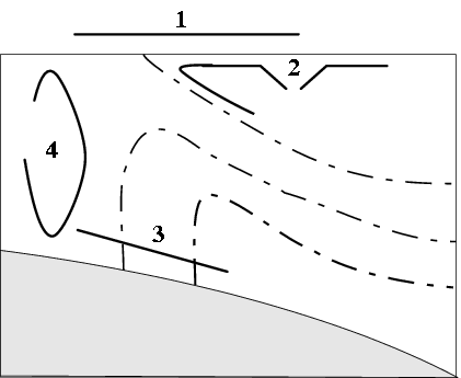
Preliminary examination by R. Beardsely and S. Gallager (WHOI, personal communication) has yielded a schematic of physical dynamics in the tidal-mixing frontal region on the southern flank of Georges Bank (Fig. 2), which they have used to propose hypotheses regarding cross-frontal transport of several target species, including fish larvae and copepods. According to their hypothesis, Pseudocalanus spp. will be found predominantly in the well-mixed area and not be transported across the front into stratified water.
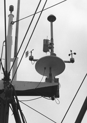
Temperature profiling as part of the FleetLink project
During Summer 2001, one of the FleetLink vessels will conduct a high resolution sampling of the sea surface and water column temperature in the tidal mixing front region on the sourthern flank of Georges Bank. The goal will be to complete 6 to 8 transects across the tidal mixing front between 40 m and 100 m depth. During each transect, underway sea surface temperature will be measured, and vertical temperature profiles will be taken at 5 km intervals along the transect.
The sea surface temperature data will be telemetered to the FleetLink data server at WHOI and will appear on the project web site. The surface temperature data will be used to locate the tidal mixing front, and ensure adequate sampling on either side of it.
Logistical details for cruise planning
Gear set-up: 20 pound chain on polypropylene line; VemCo and NetSensor on same line; both sensors 2 meters above weight
Cruise plan
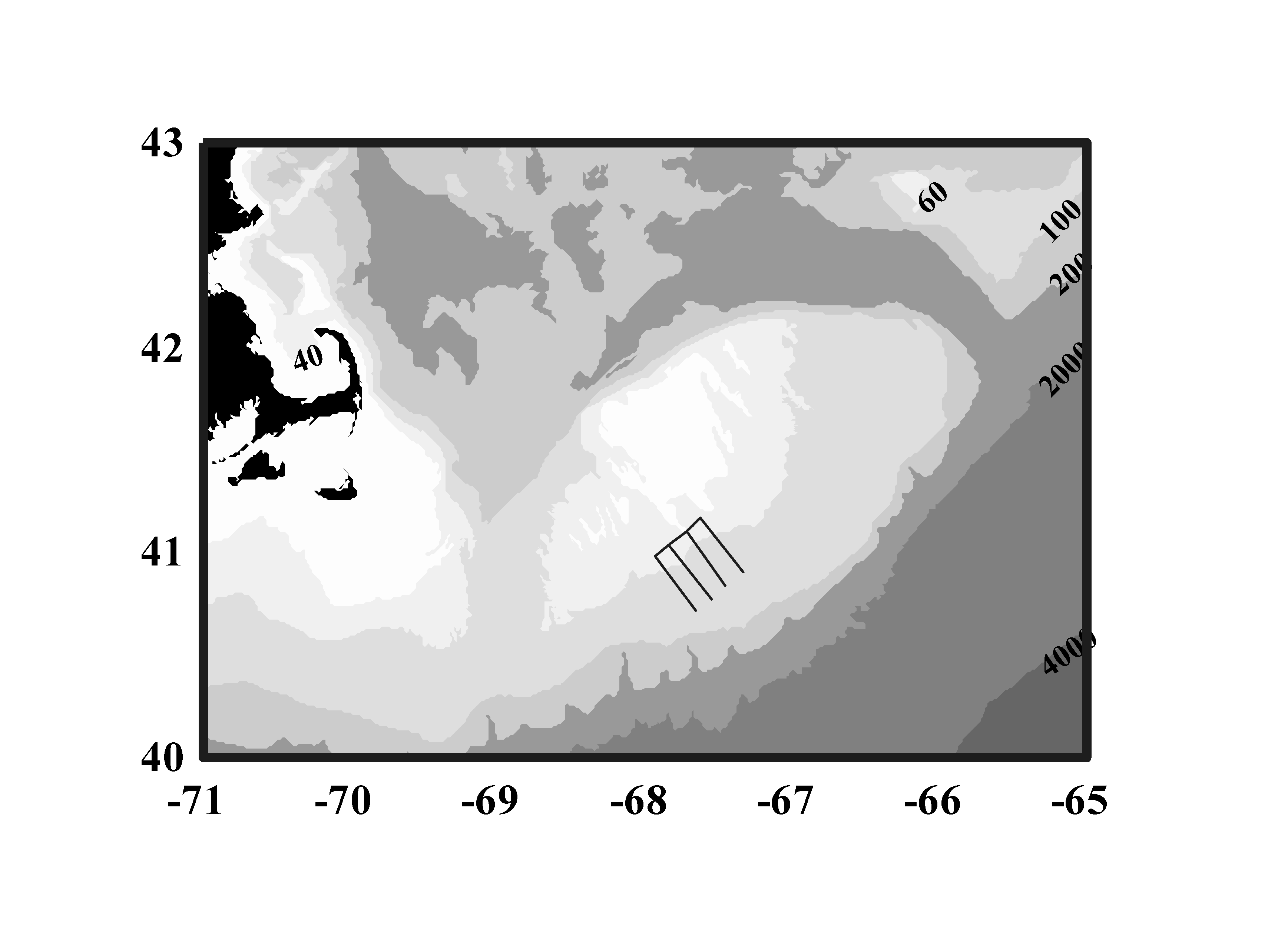
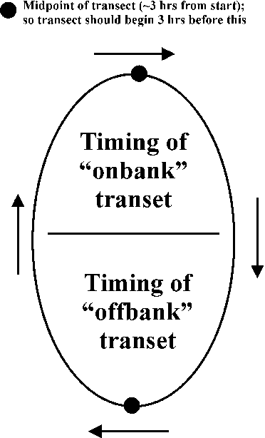
The general plan includes replicate cross-isobath transects on and off the Bank in a parallel series moving east to west (Fig. 3). Transects are 20 miles long (with 5 miles separating each transect) with profiles to be taken every 2 and ˝ miles along the transects. Estimated timing of each transect is 3 hours steaming and 3 hours at the stations (i.e., 9 profiles at 20 minutes each). The timing of each transect should be done so that at the mid-point of each transect, the tidal flow is either maximum onbank or maximum onbank in the tidal ellipse (Fig. 4). One suggestion would be begin the first transect 3 hours before tidal maximum, and complete both transects in Leg I during that tidal cycle. Work on Leg II could begin after the transit to the next Leg and after a rest. Also, lJim Bisagni for AVHRR print-out and any other satellite imagery.
Cruise track: endpoints for the cruise, with estimated timing:
Transit: Fairhaven to first point (175 miles; 22 hours)
Test drop: Great South Channel in about 80 m of water and test the gear and data collection
Leg I (12 hours)
Onbank endpoint 41o 10'; 67o 37'
Offbank endpoint 40o 54'; 67o 20'
Leg II (12 hours)
Onbank endpoint 41o 06'; 67o 43'
Offbank endpoint 40o 50'; 67o 27'
Leg III (12 hours)
On bank endpoint 41o 2'; 67o 50'
Offbank endpoint 40o 46'; 67o 33'
Leg IV (12 hours)
Onbank endpoint 40o 59'; 67o 56'
Offbank endpoint 40o 43' 67o 39'
Transit: Endpoint to Fairhaven (175 miles; 22 hours)